Aeolian Island 2014 Summer Archaeology
Why Go? Fly ‘n Dive!
Bring with you only your dive suite! Prepare to dive everyday in shallow cobalt water or into the deep blue looking for amphoras, submerged volcanoes and much more...
unlimited dives + equipment rental + boat trip at only 550 euros per pax per week! special fares for accommodations and groups.
Don’t forget to bring with you your family and friends!
Mission 2014: Discover Underwater Archaeology
Rising out of the cobalt blue seas of Sicily’s northeastern coast, the Unesco- protected Aeolian Islands are a little piece of paradise, a magical outdoor playground offering thrills and spills at every turn. Thanks to the special partnership with the Soprintendenza del Mare and the Municipality of Lipari we will have a FREE unlimited access to all the restricted archaeological dive sites of the Archipelago. Only with us you will explore ancient roman’s wrecks from the I Century AC, never touched by humans, full of amphoras and mystery. Divers will be involved in the first archaeological survey of the Aeolian’ Sea with the support of new and innovative scientific research instruments: Sonar Scanner 3D, Multibeam Echoesounder, ROV and AUV.
We will realize the first videodocumentary of five Roman’s wrecks using at the same time optical and acoustic instruments creating a full 3D map of the seabed.
All GUE divers, from Fundy to RB level could join the project and get the Free Unlimited Archaeo Pass to dive where none has never dived before.
A big challenge and a great opportunity to improve your diving skills, knowledge and attitude with the supervision of archaeologists and scientists. A multidisciplinary work program and a real experience of true exploration.
To guarantee the best and safe dives we will accept at maximum six divers per week, check out on www.gue.com how to join us in this incredible new adventure!
Testing the new Konsber MS1000 Sonar Scanner
Ready for summer 2014?
We are working together with the Italian Carabinieri and the OGS to test a new system to get HD 3D imaging and profiling of the seabed. We will use the new Konsberg MS1000 Sonar Scanner in the deep Roman wrecks of Panarea to create a 3D Virtual Map of the sites.
Using acoustic systems to detect the seabed will give us the possibility to expand our knowledge and collect data with an unmatcheable definition.
- 3D profiling possible with rotating device
- Track Plotter module allows user to plot scanned area, geo-reference targets and create GeoTIFFs
- Target tracking
- Simultaneous multi-head operation
- Coordinate system support – supports local coordinate system for different countries and territories
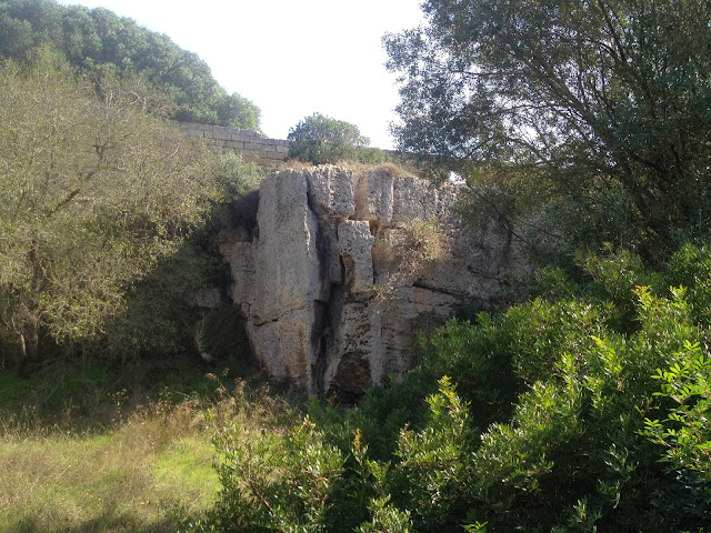
the History of Cusa Quarries
About ten kilometres to the west of Selinunte the Greek engineers found the best stone for their magnificent projects. The bank of Limestone was long and deep and the stone itself was compact enough for the Quarries, specifically the Latomie and the Porche, much nearer the city.
The Cusa Quarries have not rivals as far as sheer size and their state of conservation is concerned. It has been possible to analyse every phase og the quarrying process.
The Quarries were in use from the 6th Century BC until the destruction of the city. the Punic conquest of the city interrupted work in the quarry almost from one moment to the next, and the pieces of stone were abbandoned at the stage they were at. Some had only just been startefd to the newn from the bedrock, while others had been detached, finished and had already startefd on their journey towards the city.
Enjoy!
Pictures by GUE and Lundgren Brothers. Powered by Blogger.


