Lost Island Project: What we are lookin' for


Read More »

Explorin Mount Etna


Mount Etna  is an active stratovolcano on the east coast of Sicily, Italy, close to Messina and Catania. It lies above the convergent plate margin between the African Plate and the Eurasian Plate. It is the tallest active volcano on the European continent, currently standing 3,329 m (10,922 ft) high, though this varies with summit eruptions. It is the highest mountain in Italy south of the Alps. Etna covers an area of 1,190 km2 (459 sq mi) with a basal circumference of 140 km. This makes it by far the largest of the three active volcanoes in Italy, being about two and a half times the height of the next largest, Mount Vesuvius. Only Mount Teide in Tenerife surpasses it in the whole of the European–North-African region. In Greek Mythology, the deadly monster Typhon was trapped under this mountain by Zeus, the god of the sky and thunder and king of gods, and the forges of Hephaestus were said to also be located underneath it.
Mount Etna is one of the most active volcanoes in the world and is in an almost constant state of activity. The fertile volcanic soils support extensive agriculture, with vineyards and orchards spread across the lower slopes of the mountain and the broad Plain of Catania to the south. Due to its history of recent activity and nearby population, Mount Etna has been designated a Decade Volcano by the United Nations.In May 2013, it was accepted as a UNESCO World Heritage Site, and its official proclamation is scheduled for June.
Volcanic activity first took place at Etna about half a million years ago, with eruptions occurring beneath the sea off the ancient coastline of Sicily.About 300,000 years ago, volcanism began occurring to the southwest of the summit (centre top of volcano) then, before activity moved towards the present centre 170,000 years ago. Eruptions at this time built up the first major volcanic edifice, forming a stratovolcano in alternating explosive and effusive eruptions. The growth of the mountain was occasionally interrupted by major eruptions, leading to the collapse of the summit to form calderas.
From about 35,000 to 15,000 years ago, Etna experienced some highly explosive eruptions, generating large pyroclastic flows, which left extensive ignimbrite deposits. Ash from these eruptions has been found as far away as Rome, 800 km (497 mi) to the north.
Thousands of years ago, the eastern flank of the mountain experienced a catastrophic collapse, generating an enormous landslide in an event similar to that seen in the 1980 eruption of Mount St. Helens. The landslide left a large depression in the side of the volcano, known as 'Valle del Bove' (Valley of the Ox). Research published in 2006 suggested this occurred around 8000 years ago, and caused a huge tsunami, which left its mark in several places in the eastern Mediterranean. It may have been the reason the settlement of Atlit Yam (Israel), now below sea level, was suddenly abandoned around that time.
The steep walls of the valley have suffered subsequent collapses on numerous occasions. The strata exposed in the valley walls provide an important and easily accessible record of Etna's eruptive history.
The most recent collapse event at the summit of Etna is thought to have occurred about 2,000 years ago, forming what is known as the Piano Caldera. This caldera has been almost entirely filled by subsequent lava eruptions, but is still visible as a distinct break in the slope of the mountain near the base of the present-day summit cone.
Large lava flow from an eruption in 1928 led to the first (and only) destruction of a population centre since the 1669 eruption. The eruption started high on Etna's northeast flank on November 2. Then new eruptive fissures opened at ever lower elevation down the flank of the volcano. The third and most vigorous of these fissures opened late on 4 November at an unusually low elevation, approximately 1,200 m (3,937 ft) above sea-level, in a zone known as Ripe della Naca. The village of Mascali, lying down-slope of the Ripe della Naca, suffered obliteration in just two days, with the lava destroying nearly every building. Only a church and a few surrounding buildings survived in the north part of the village, called Sant'Antonino or "il quartiere". During the last days of the eruption, the flow interrupted the Messina-Catania railway line and destroyed the train station of Mascali. The event was used by Benito Mussolini's Fascist regime for propaganda purposes, with the evacuation, aid, and rebuilding operations being presented as models of fascist planning. Mascali was rebuilt on a new site, and its church contains the Italian fascist symbol of the torch, placed above the statue of Jesus Christ. In early November 2008, the town of Mascali commemorated the 80th anniversary of the eruption and destruction of the village with a number of public events where eyewitnesses shared their memories of the eruption.
Other major 20th-century eruptions occurred in 1949, 1971, 1981, 1983 and 1991–1993. In 1971, lava buried the Etna Observatory (built in the late 19th century), destroyed the first generation of the Etna cable-car, and seriously threatened several small villages on Etna's east flank. In March 1981, the town of Randazzo on the northwestern flank of Etna narrowly escaped destruction by unusually fast-moving lava flows. That eruption was remarkably similar to one in 1928 that destroyed Mascali. The 1991–1993 eruption saw the town of Zafferana threatened by a lava flow, but successful diversion efforts saved the town with the loss of only one building a few hundred metres from the town's margin. Initially, such efforts consisted of the construction of earth barriers built perpendicularly to the flow direction; it was hoped that the eruption would stop before the artificial basins created behind the barriers would be completely filled. Instead, the eruption continued, and lava surmounted the barriers, heading directly toward Zafferana. Engineers then decided to use explosives near the source of the lava flow, to disrupt a very efficient lava tube system through which the lava travelled for up to 7 km (4 mi) without essentially losing heat and fluidity. The main explosion on 23 May 1992 destroyed the tube and forced the lava into a new artificial channel, far from Zafferana, and it would have taken months to re-establish a long lava tube. Shortly after the blasting, the rate of lava emission dropped, and during the remainder of the eruption (until 30 March 1993) the lava never advanced close to the town again.
Following six years (1995–2001) of unusually intense activity at the four summit craters of Etna, the volcano produced its first flank eruption since 1991–1993 in July–August 2001. This eruption, which involved activity from seven distinct eruptive fissures mostly on the south slope of the volcano, was a mass-media eruption, because it occurred at the height of the tourist season and numerous reporters and journalists were already in Italy to cover the G8 summit in Genoa. It also occurred close to one of the tourist areas on the volcano, and thus was easily accessible. Part of the "Etna Sud" tourist area, including the arrival station of the Etna cable car, were damaged by this eruption, which otherwise was a rather modest-sized event by Etna standards.
In 2002–2003, a much larger eruption threw up a huge column of ash that could easily be seen from space and fell as far away as Libya, 600 km (370 mi) south across the Mediterranean Sea. Seismic activity in this eruption caused the eastern flanks of the volcano to slip by up to two metres, and many houses on the flanks of the volcano experienced structural damage. The eruption also completely destroyed the tourist station Piano Provenzana, on the northeastern flank of the volcano, and part of the tourist station "Etna Sud" around the Rifugio Sapienza on the south flank. Footage from the eruptions was recorded by Lucasfilm and integrated into the landscape of the planet Mustafar in the 2005 film Star Wars Episode III: Revenge of the Sith.The Rifugio Sapienza is near the site of a cable car station which had previously been destroyed in the 1983 eruption; it has now been rebuilt. Following a rather silent, slow and non-destructive lava outflow on the upper southeastern flank between September 2004 and March 2005, intense eruptions occurred at the Southeast Crater in July–December 2006. These were followed by four episodes of lava fountaining, again at the Southeast Crater, on 29 March, 11 April, 29 April and 7 May 2007. Ash emissions and Strombolian explosions started from a vent on the eastern side of the Southeast Crater in mid-August 2007.
On 4 September 2007 a spectacular episode of lava fountaining occurred from the new vent on the east side of the Southeast Crater, also producing a plume of ash and scoriae which fell over the east flank of the volcano. A lava flow travelled about 4.5 km (2.8 mi) into the uninhabited Valle del Bove. This eruption was visible far into the plains of Sicily, ending the following morning between the hours of 5 to 7 am local time.
An eruption on the morning of 13 May 2008, immediately to the east of Etna's summit craters was accompanied by a swarm of more than 200 earthquakes and significant ground deformation in the summit area. The eruption continued at a slowly diminishing rate for 417 days, until 6 July 2009, making this the longest flank eruption of Etna since the 1991–1993 eruption that lasted 473 days. Previous eruptions, in 2001, 2002–2003, and 2004–2005 had lasted 3 weeks, 3 months, and 6 months, respectively. Lava flows advanced 6.5 km during the first few days of this eruption but thereafter stagnated at much minor distances from the vents; during the last months of the eruption lava rarely advanced more than 1 km downslope.
Through January 2011 to February 2012, the summit craters of Etna were the site of intense activity. Frequent eruptions and ash columns forced the authorities to shut down the Catania airport on several occasions. The July 2011 episode also endagnered the Sapienza Refuge, the main tourist hub on the volcano, but the lava flow was successfully diverted.
In 2012 and 2013, activity subsided to more moderate levels, with regular but contained eruptions at Southeast Crater and Bocca Nuova.


Enjoy!

Read More »

Documentation of the Hill of the Vulcanelli - National reserve of Macalube Aragona

Documentation Set in the Natural Reserve "Macalube of Aragona".
A series of little volcanoes of mud describing a lunar landscape.
The Reserve is born to protect a rare geologic phenomenon that, in analogy with the volcanic one, is defined sedimentary volcanism. This type of phenomenon has to be included in that superficial oil manifestations of gaseous type.
The sedimentary volcanism manifests itself in presence of gas submitted to certain pressure and in relationship with clays not consolidated which are intercalated in levels of saltuy water.
The gases of the Macalube are essentialy constituted be methane. These, owning to pressure, escape from the subsoil, through discontinuity fo the ground, dragging with itself clayey sediments and water that, deposing itself in the surface, gives place to a cone of mud, from whose summit, through a crater, the gas escapes.
There is therefore a morphological analogy with the volcanic apparatuses.
periodically the hillock of the Macalube is stunned by explosive eruptions, accompanied by roars, with expulsion of clayey material mixed to gas and water which are cast to notable height because of the pressure of gas accumulated, in the time, below its surface.
The Natural Integral Reserve Macalube of Aragona, is at a distance of about 4 km S.O. from Aragona and 15 k  N. from Agrigento. The area is characterized by sweet forms, constituted by predominantly clayey deposists and ploughed by a thick net of deep valleys, which are periodically crossed by the waters collected by seasonal precipitations.
In this general context strands the hill of the Vulcanelli.
It is a bare moor of grey and whitish colour, from which a series of little volcanoes of mud, tall around the meter, raise almost to remember a lunar landscape.

Enjoy!

Read More »

The Light in the Dark

What happened to living life to the fullest? Where is the daring adventure that we dreamed about as a kid? Many of us have lost the passion for adventure that filled our childhood, and as real men we should struggle to regain it. For in true adventure we find much more than the cheap thrill of adrenaline, we find ourselves. Adventure is the element of a full life that is perhaps most neglected in modern society, and it is one of the most crucial. To have grand adventures and be able to tell tales of them is central to manliness. The problem is that in our age of technological revolution we have written off adventure and exploration as things of the past, no longer necessary thanks to our newfound, ever evolving capabilities. Although true exploration, in the sense of discovering new things, is now mostly the realm of astronauts and deep sea divers, adventure is available to anyone. What we need to realize is that it is not the discovery of new things that is important for the average man, but the understanding of ourselves which we often acquire through high adventure. Perhaps it is best to look to an old pro in the art of adventure for some insight into the true reasoning behind it.
Sir Wilfred Thesiger (1910-2003), an English explorer best known for his adventures throughout Africa and the Middle East and for adopting the lifestyles of the nomadic people he often stayed with, became famous as the first man to cross the Rub’ al Khali, aka “The Empty Quarter.” The Empty Quarter is one of the largest sand deserts in the world, compromising a large portion of the southern half of the Arabian Peninsula. It is composed of 250,000 square miles of the most deadly terrain on terra firma, with sand dunes that climb well over 1000 feet and summer temperatures over 130 degrees Fahrenheit. Thesiger set out to cross this great expanse and planned to create a map of the region during his journey. He succeeded, crossing the vast unknown of the Empty Quarter not once, but twice, between 1946 and 1949. Recalling the first time he drank water without need to ration it upon his return, he wrote the following;
“For years the Empty Quarter had represented to me the final, unattainable challenge which the desert offered…To others my journey would have little importance. It would produce nothing except a rather inaccurate map which no one was ever likely to use. It was a personal experience, and the reward had been a drink of clean, nearly tasteless water. I was content with that.”
For Thesiger, and for many other adventurers before and long after, it was the adventure itself that was the prize, and the experience gained from it was worth more than any commemoration. He would later write;
“For me, exploration was a personal venture. I did not go to the Arabian Desert to collect plants nor to make a map; such things were incidental. At heart I knew that to write or even to talk of my travels was to tarnish the achievement. I went there to find peace in the hardship of desert travel and the company of desert peoples…It is not the goal but the way there that matters, and the harder the way the more worthwhile the journey.”
Thesiger knew all too well that adventure offered greater rewards for a man than most other things in life. Not rewards in a material sense, but in the immense satisfaction of setting your sights on an achievement and accomplishing it.
Obviously, adventure isn’t what it used to be. Everest has been knocked off more times than you can count, they are paving a highway across the Sahara, and you can check out the secrets of the Amazon by satellite right from your laptop. But does all this mean that adventuring is a lost art? Hardly. As we have seen from testimony of a great adventurer like Thesiger, the thirst for adventure does not come from a need to map out new lands or discover new species, those are secondary objectives. The thirst for adventure comes from within ourselves. It is our inner desire to expand our knowledge through firsthand experience, to test the limits of our own strength and endurance, and in doing so, discover our true self.
The choice to live an adventurous lifestyle is not an easy one. It is very difficult to break free of the monotonous routine of daily life when you have been repeating it for years on end. You can easily come up with a handful of excuses why you shouldn’t book that weekend whitewater rafting trip, travel to a foreign country, or make an appointment for your first SCUBA lesson. I can’t get off of work, I shouldn’t spend the money, who will watch the kids, etc. There is only one way to break the routine, and that is to just do it. Keep in mind the words of George Mallory, known for attempting the first ascent of Everest;
“What we get from this adventure is just sheer joy. And joy is, after all, the end of life. We do not live to eat and make money. We eat and make money to be able to live. That is what life means and what life is for.”
Perhaps it is time for men to seek to regain the element of adventure that originally drove those before us to cross oceans and vast expanses of unknown terrain with no hope of return. We need to bring risk back into our lives. If we are to truly embrace the adventurous life, we must find within ourselves the daring resolve to snatch up our mere existence and drive it to the edge of possibility, knowing full well that the future holds no guarantee for safety, prosperity or happiness and that a full life is not given, it is taken.

Enjoy!

Read More »

News from the Independent

The Island that Time Remembered
the Independent Digital

Once, it was a cause célèbre: a strategically important volcanic island in the Mediterranean that Britain, France, Spain and Sicily all claimed as their own. Then, in 1831, it sank beneath the sea. Now, inch by inch, Graham Island is rising to the surface again. And already the territorial squabbling has resumed by Rose George
26 September 2001
It began with the boiling of waters, 22 miles from the island of fire. It was July 1861, and off the coast of southern Sicily - the fiery island of volcanoes - in the Sicilian Channel between Europe and Africa, strange things were happening. There was a terrible smell of sulphur in the air, and jets of hot water and cinders were spat from the ocean. Dead fish floated on the surface. Commander Charles Henry Swinburne, standing on the British naval frigate HMS Rapid, watched as for only the second time since 10BC, one of Sicily's lesser-known volcanoes rose up from the sea, setting off an international dispute between Britain and Italy that is still, theoretically, unresolved.
The British returned in August 1831, claiming the now sizeable hillock as Graham Island, after the First Lord of the Admiralty, and gleeful at grabbing such a strategic lump of rock: closer to Europe than Malta, Graham Island was a perfect point to control commercial and military sea traffic in the major Mediterranean shipping lanes. The Sicilians - Italy wouldn't be unified until 1870 - indignantly sent a ship to claim the island for the Bourbon Kingdom of the Two Sicilies, whose captain removed the Union Jack and named the island Ferdinandea, after King Ferdinand II. The Spanish showed an interest too, while the French sent a geologist to name it Giulia, on the prosaic grounds that it had appeared in the month of July.
For five months, conflict raged in newspapers, as three nations fought over a 60m-high lump of basalt. Tourists travelled to the island to see its two small lakes and four-kilometre circumference; hardy visitors climbed to its summit through clouds of noxious gas. Sailors watched with suspicion, muttering of magic forces that must make the island pop up and down, while the nobles of the House of Bourbon reportedly planned to set up a top-class holiday resort on its beaches. But it was no use. Little by little, the island sank back beneath the waters, and by 17 December 1831, two Neapolitan officials reported no trace of it. The volcano had been drawn back down into the sea by the movement of the tectonic plates, the same way it had arisen, and the dispute was seemingly resolved - no territory, no territorial claim.
Until now. The seamount (a seabed volcano) of Graham/Ferdinandea has lived on in charts, its summit - only eight metres below the surface - a constant hazard for shipping. Occasionally it has made its presence known, alarming fishermen with its steaming. In 1987, an American pilot on the way to bomb Libya thought the rock a submarine, and dropped depth charges on it. In 1995, tremors along the Sicilian coast were blamed on Ferdinandea. Then last year, the squabble over a non-existent island spluttered once more into life.
Domenico Macaluso is a surgeon in Sciacca, the coastal town nearest to Ferdinandea, as he calls it ("You'll be wanting to call it Graham, I suppose," he says on the phone). A keen diver, and a volunteer Inspector of Sicilian Cultural Riches, he was horrified by the underwater foraging of the famed American diver Robert Ballard, who had been poking around in the Sicilian Channel and began to take an interest in Ferdinandea. Macaluso's interest intensified last year. "It was 5 February 2000," he states with obsessive precision, when a bout of volcanic activity prompted a newspaper article entitled "A long vanished piece of the British Empire is about to resurface". This caused "a certain embarrassment in certain quarters", says Macaluso, including in the Italian Ministry of Foreign Affairs. Anxiety pricked by rumours that two British navy ships had been sniffing around the area, possibly checking out the truth of the press story, the Italian government asked for a report on the situation from its voluntary cultural inspector.
There was no chance of Ferdinandea re-emerging any time soon, the report concluded, but that didn't mean it wouldn't, one day. After all, the British had never made a formal claim to Graham, beyond sticking a flag on it. Ferdinand II had gone further, declaring with an Act of Annexation that Ferdinandea belonged to the Kingdom of Two Sicilies. But under international maritime law, Ferdinandea/Graham lies just outside Italy's 12-mile territorial waters. In theory, anyone - from Libya opposite, to nostalgic imperialists in the British fleet, to the House of Bourbon - could claim it, and the waters between Africa and Europe are as strategic now as in 1831.
Macaluso decided to take action. "I'm not political," he stresses, but he is determined. He persuaded Ferdinand's descendant, Prince Carlos of Calabria, who'd never set foot in Sicily, to take part in a "cultural initiative", in the form of a 150kg marble plaque, inscribed with the coats of arms of the House of Bourbon, the Italian Navy and the town of Sciacca, and with the words: "This piece of land, once Ferdinandea, was and shall always belong to the Sicilian people." It was all done in the name of the long-dead Ferdinand of Bourbon, Duke of Castro, and placed 20m below the surface in March this year, an event commemorated by the Italian media. The publicity brought curious tourists back to this anonymous patch of sea where there was nothing to see.
It brought someone else, too, because when Macaluso dived down to the island four weeks ago, he found his beloved plaque in pieces. Twelve pieces, actually, apparently bearing the marks of severe blows. He cried foul. "It's vandalism!" Italian newspapers, remembering the G8 protests in Genoa, speculated about a "Black Bloc" of underwater anarchists. More sober observers pointed to fishing anchors, accidental damage, maybe an earthquake, but Macaluso is unconvinced. "It was a considerable undertaking, to dive down there. If it had been an anchor, it would have broken in two, not 12 pieces. It was deliberate." Could it have been the dastardly British? "I don't think they could be bothered to get in a sub and go and break a piece of marble. Maybe it was someone with a grudge against the Bourbons."
Filippo D'Arpa, a journalist with Il Giornale di Sicilia, pours cold water on any conspiracy theories. His novel on the events of 1831 - The Island That Went Away - published this month in Italy, is "a metaphor on the ridiculousness of power. This rock is worth nothing, it's no use as a territorial possession, and yet the English, the French and the Bourbons fought over it and nearly came to war". Even so, "even now there's a strong rivalry, because the ownership of the island has never been established. It's very peculiar that 160 years later, English and Italians are still fighting over this."
Not so, says the Foreign Office spokeswoman, who downplays any claim, but knew exactly where Graham Island was. She asks briskly whether a quote she gave Time magazine would be OK. "I think we said we weren't going to make waves about it, or something humorous. It's that kind of level."
But it pays to take small islands seriously, however insignificant they seem. Three miles off Southend-on-Sea, Roy and Joan Bates have defied Her Majesty's Government for 30 years to claim sovereignty for their principality of Sealand (actually a concrete gun fort).
Japan's 200-mile exclusive economic zone uses a boundary marked by humble crops of coral surrounded by concrete. And in the book Lost Islands the oceanographer Henry Stommel listed many more undiscovered islands - marked on charts, but missing - which could be claimed for offshore banking services, principalities or radio stations, if anyone could find them.
"It's a very thorny issue," says Martin Pratt of the University of Durham's International Boundaries Research Unit. "You can't have sovereignty without territory, and you usually need some kind of continuous possession. But theoretically, if it did emerge again, it's outside Italian territorial waters, and someone could possess it and claim it."
An Italian naval captain recently wrote an article about Ferdinandea entitled "A Virtual Dispute". But a dispute it still is. Enough for Macaluso to be invited to Brussels to discuss the situation at official level, and for the Belgian newspaper Le Soir to put the story in full-colour on its front page. Enough for physicist Antonio Zichichi, who keeps an eye on the volcano from the Ettore Majorano Centre at Erice, to say immediately, "We're not interested in any plaques!" Zichichi heads a project "to understand what's going on in that part of the sea", including correlations between Ferdinandea's activity and seismic shocks on Sicily's southern coast. "I intervened because people were saying such stupid things about Ferdinandea - that it was magic, that it was going to erupt. It goes up and down because the earth's crust goes up and down, and that's that." But a Nato report last year about a similar seamount off northern Sicily speculated that a new emergence could cause huge tidal waves. And even Zichichi, a strong believer in Galileo's dictum that our lives must be governed by facts, admits that for now, Ferdinandea hasn't supplied many. "People should have started monitoring 20 years ago, not five," he says. "It's a very difficult task - in the advanced frontiers of geophysics, it's impossible to predict seismic events."
And as long as the possibility that the non-existent island will exist again cannot be ruled out, the virtual dispute can rumble on. So Macaluso is determined to replace the plaque. The tourists will continue to circle over a volcano eight metres underwater. In government offices, files will build up on the what-ifs. And meanwhile, the volcano called Ferdinandea or Graham bubbles away, causing eruptions and waves in the realm of hypothesis, while its mineral sands sprout with lush underwater plants. The aristocratic beach resort is now a haven for fish and 40 varieties of microsnails. Coral has begun to form. "It's an underwater paradise," says Macaluso. "I'd prefer it to stay down there. It's better that way, for everybody."

Enjoy!

Read More »

Our Sky


Enjoy!

Read More »

First thing to do...Explore the Lost Island!

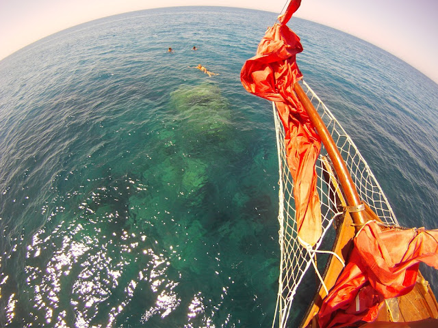
The first phase of the project is simply to explore the dive site. The island of Ferdinandea reaches from about 300 meters deep to 8 meters deep at its peak. The rise of the underwater island stops near the surface, forming a large plateau at about 50 meters depth. The exploratory phase will last about a month and focus on an 8-square-mile area of the island that rises from 50 meters to 8 meters deep.
The plan is to divide the seamount in different areas, tracing the lines from the top get to the bottom of the plain, creating first vertical lines and then placing horizontal lines, so as to create rectangles of research consisting of lines left on the bottom of the posts using steel. Each sector will be numbered and located via GPS system, to allow us to create a map of the bottom. The creation of a detailed map of the seabed with GPS coordinates will allow us to georeference our scientific investigations and record the exact location of the samples we're going to take. The map will also be compared with the multibeam scan in order to add greater detail.
The first dive’s goal will be an overview of the area: before proceeding with the placement of the lines, we need to obtain a global view of the environment with which we are going to interact. In these exploratory dives documentation will be a fundamental part of our work. Through the images and videos that will be taken, we will make the first sketches on paper of the dive site, noting immediately the particulars of the bottom. Then we will move on to the creation of the sectors and then to the subdivision of the site. This stage is very delicate because GPS coordinates must be recorded for each individual sector, a task essential for the creation of the map search. The exploration team divers will then use reels and balls to split and place the grid. The permanent camp on the bottom will require divers to be able to accurately organize systematic research, and so it must provide them with a quick way to access to the different sectors. All in all, it will be a beautiful environment in which to work. These tasks will increase the capacity of every diver in the team and help them improve in the use of specific equipment such as reels and signaling balloons. Each dive will be documented through video and photos to allow us to fix any of our mistakes and further improve our abilities.

Good luck, GUE divers!

Read More »

Exploring Agrigento


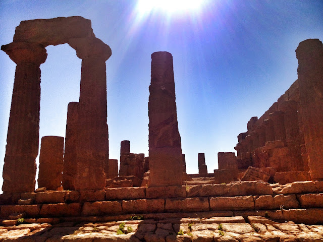
The Archaeological and Landscape Park of the Valley of the Temples extends over 1300 hectares and contains exceptional monumental and landscape heritage, which includes the ruins of the ancient city of Akragas and its surrounding territory up to the sea. In the Valley of the Temples, declared UNESCO World Heritage Site in 1997, there is one of the main archaeological complexes of the Meditterranean, immersed in a rural landscape of rare beauty characterized by the presence of century-old olive and almond trees.

Enjoy!

Read More »

Lost Island Special Offer!


Enjoy!

Read More »

Exploring the coasts near the Lost Island HQ


Enjoy!

Read More »

Don't loose the train!

Don't Loose the Train!
The SPECIAL OFFER is still available only until the 31 of May.
Go to www.gue.com and register you TODAY!
Enjoy!

Read More »

In a Cloudy Windy Day...


Enjoy!

Read More »

What a beautiful morning...

While we are working on the Halcyon equipment... a new friend comes to help us.


Enjoy!

Read More »

Shots from Agrigento


Enjoy!

Read More »

Shots from Crew Lopez


Enjoy!

Read More »

Pictures by GUE and Lundgren Brothers. Powered by Blogger.